Outcome-Based Land Management for Florida Landowners
From land clearing to conservation forestry — TreeShop delivers measurable results across 32 Florida counties. Certified professionals. CAT equipment. A real process.


"Top notch communication. Did a fantastic job on my property."
— Steven R. · Google Review
Where Do You Start?
What Kind of Project Do You Have?
Whether you need land cleared for building or a long-term management plan for your timber and wildlife — we have the equipment and the experience.
I Need Land Cleared
Building a home, prepping a site, clearing overgrown property. Under 10 acres of clearing, grading, mulching, or mowing.
View clearing servicesI Want to Improve My Forest or Habitat
Timber stand improvement, wildlife habitat restoration, fire preparation, invasive species removal. 10-500 acres of outcome-based management.
View conservation servicesI Need Ongoing Land Management
Year-round management for serious landowners. Scheduled maintenance, regrowth control, and long-term partnership. 100+ acres.
Learn about partnershipsSimple Process
How It Works
From first call to finished project. Three steps — no runaround.
Schedule a Land Assessment
Call or fill out the form. Jeremiah walks your property in person — evaluating terrain, vegetation, and equipment access to build an accurate scope and quote. Free, no obligation.
Get a Plan and Quote
You receive a clear Master Service Agreement — scope, timeline, pricing, and expectations documented before any equipment rolls. No surprises, no hidden costs.
We Execute — You Get Results
CAT equipment mobilizes to your site. Jeremiah manages production and walks the finished project with you. Owner-operated from start to finish.
What We Do
Our Services
If it grows, we manage it. Every service below is something Jeremiah handles personally — from a single tree to full acreage management across Central Florida.
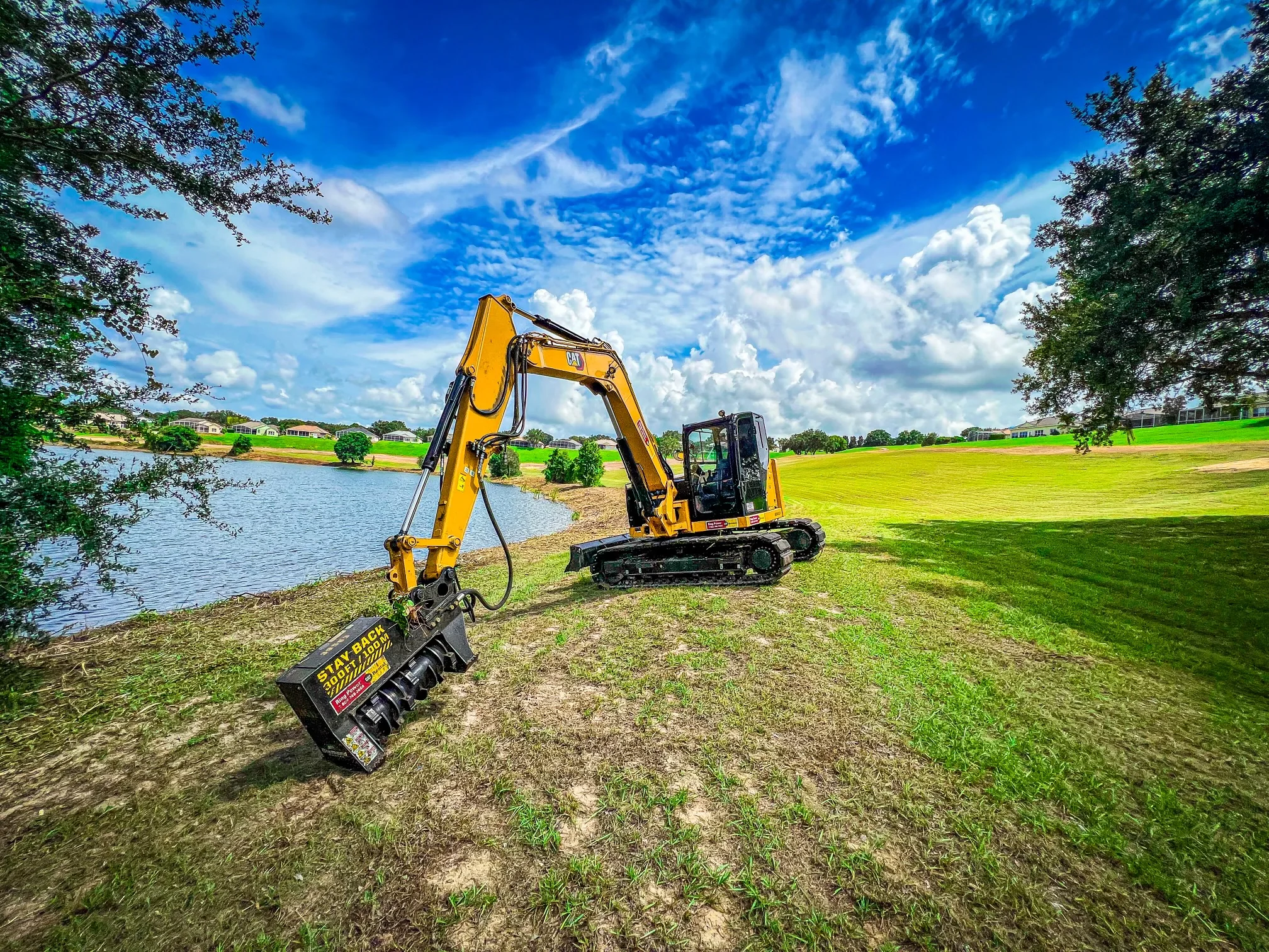
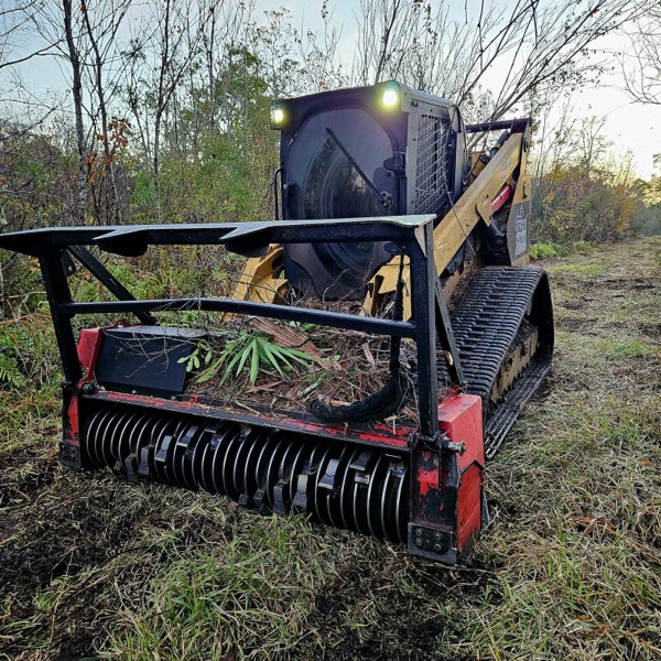
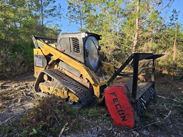
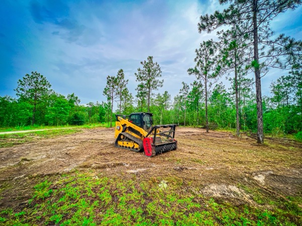
Forestry Mulching
Most PopularOvergrown land cleared to clean, usable ground — in one day
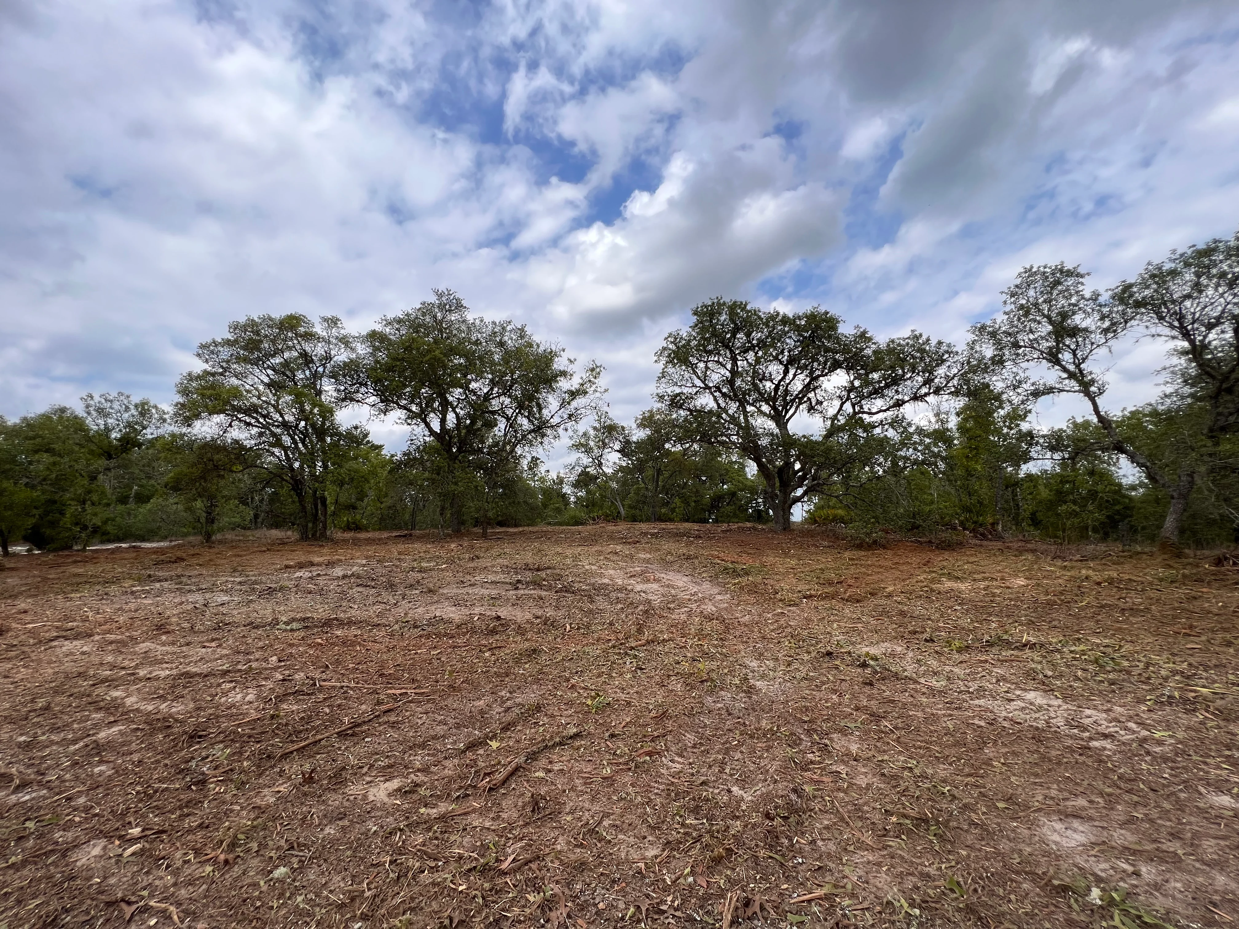
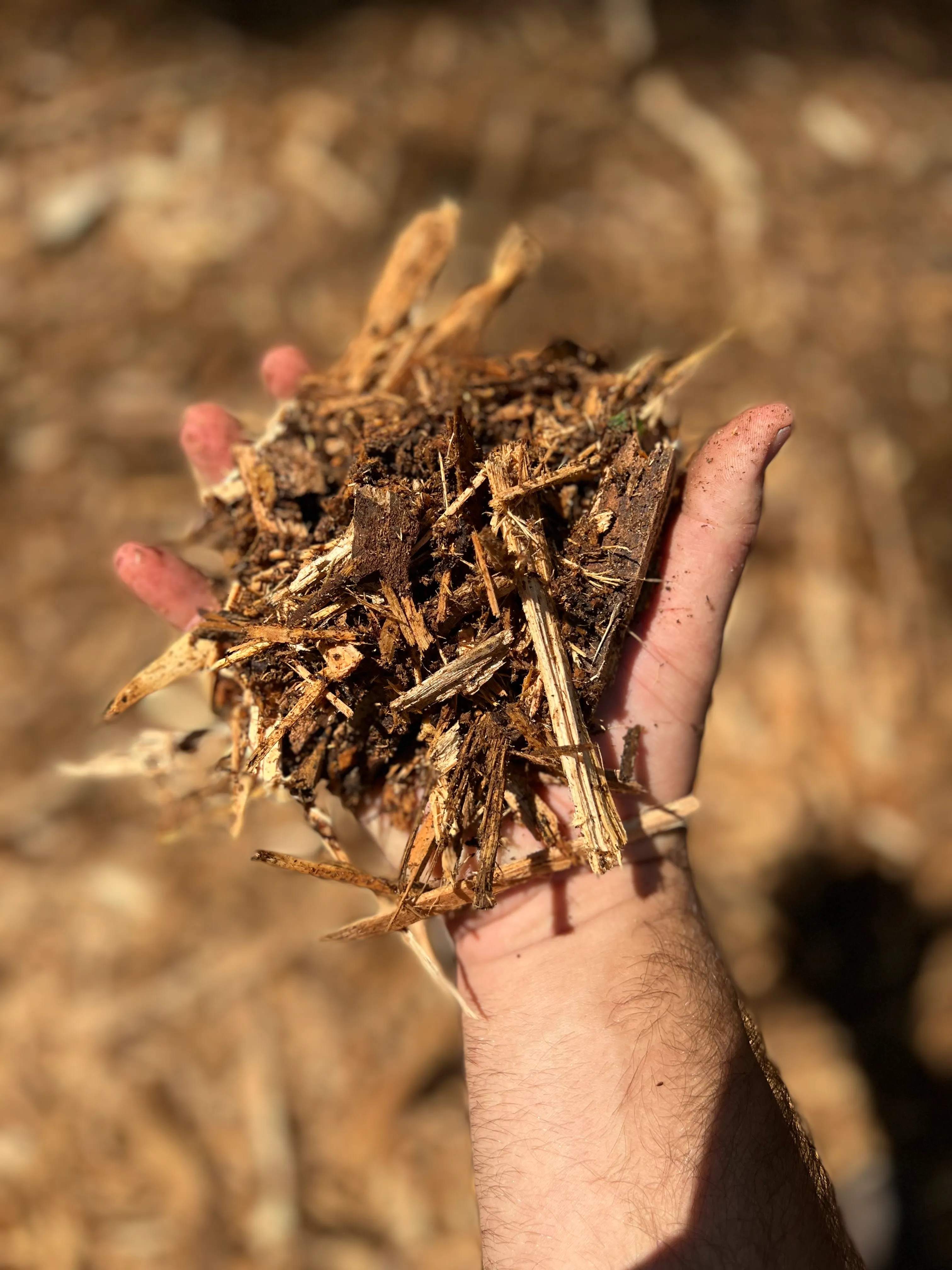
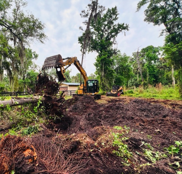
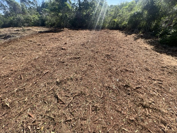
Forestry mulching uses a high-powered forestry mulcher head mounted on a CAT track loader to grind standing trees, brush, stumps, and woody vegetation into fine mulch right where it stands. Unlike traditional clearing methods, there's nothing to haul off — the organic material stays on-site as ground cover, reducing erosion, retaining moisture, and naturally decomposing back into the soil. This is the go-to service for wooded lots, overgrown properties with saplings and brush, fence line clearing, pasture reclamation, invasive species removal (Brazilian pepper, melaleuca, Australian pine), and any property where the vegetation is too heavy for a mower but doesn't require full excavation.
Ideal For
Common Questions
What's the difference between mulching and land clearing?
Can you mulch trees larger than 8 inches?
How long does forestry mulching take?
Is mulching better than burning or hauling?
Conservation & Restoration
Outcome-Based Land Management
For landowners managing 10-500+ acres of timber, wildlife habitat, or conservation land. Science-based practices, EQIP-eligible, and built for long-term results.
Timber Stand Improvement
Restoring forest health through selective midstory removal and stand density management
Learn morePrescribed Fire Preparation
Creating firebreaks and reducing fuel loads so your land is ready to burn
Learn moreWildlife Habitat Restoration
Opening the canopy to create the diverse understory structure deer, turkey, and quail need
Learn moreInvasive Species Management
Reclaiming your forest from privet, kudzu, and other invasive threats
Learn moreLongleaf Pine Restoration
Site preparation and midstory removal for America's most important forest
Learn moreFuel Load Reduction
Protecting your property and your neighbors by managing hazardous fuels
Learn moreLand Reclamation
Transforming overgrown acreage into productive, accessible land
Learn moreEQIP Conservation Practices
Professional land management services that qualify for up to 75% federal cost-share reimbursement
Learn more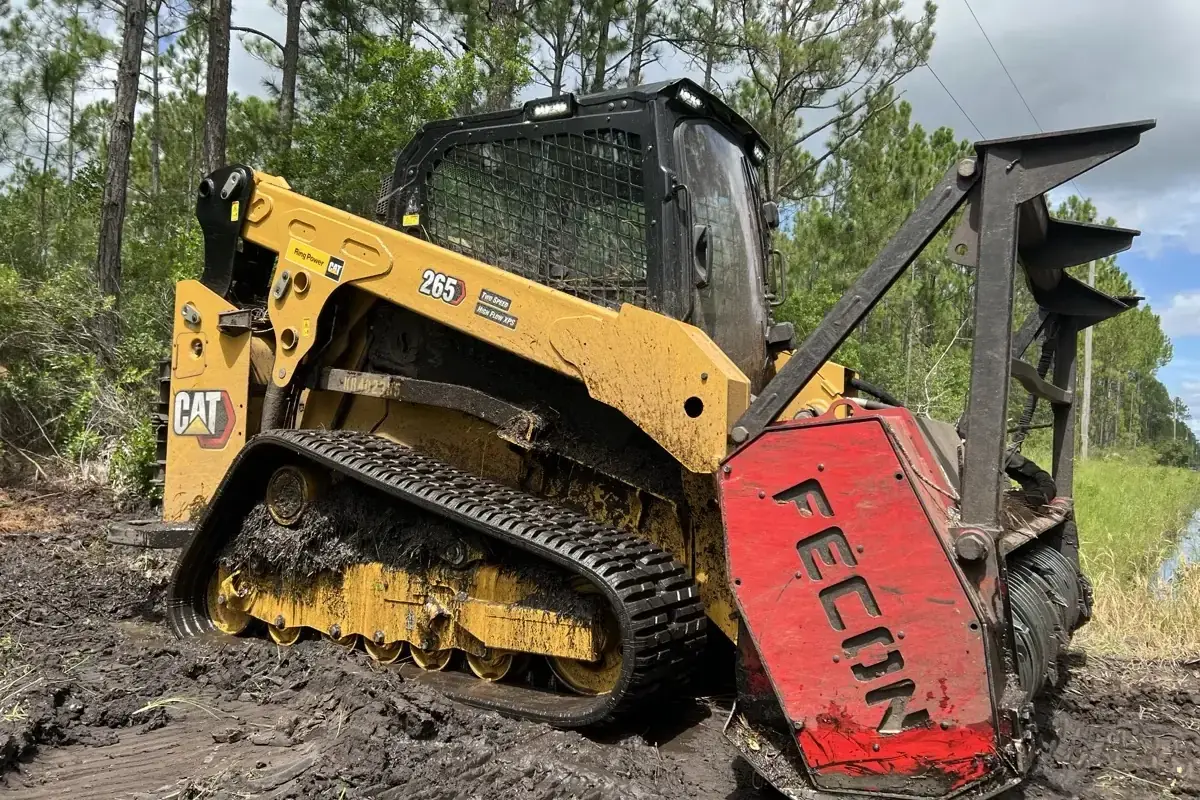
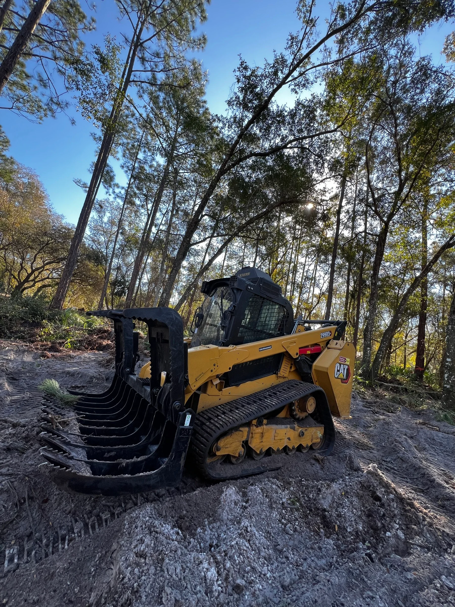
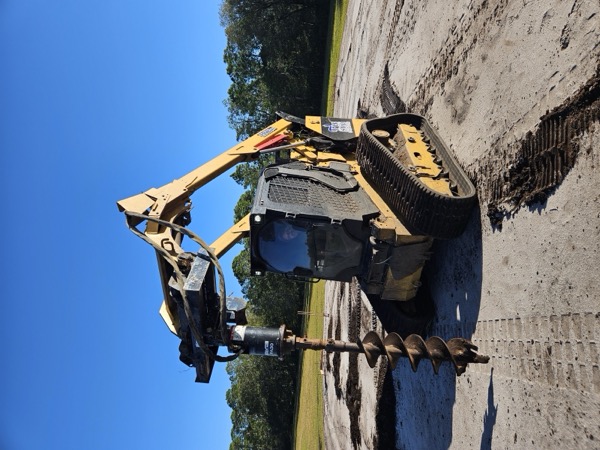
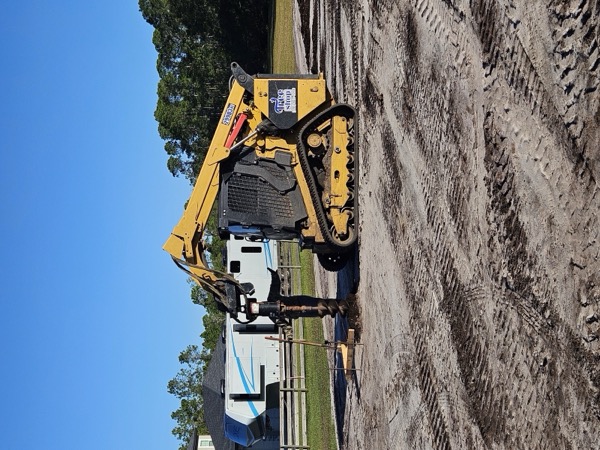
Equipment & Expertise
The Right Equipment.
The Right Approach.
Professional-grade CAT track loaders and 20+ ton excavators — purpose-built for Florida land management. But equipment is only half the equation. The other half is understanding your land, your goals, and the outcome you're after.
Reviews & FAQ
Common Questions, Real Answers
How is TreeShop's communication and professionalism?
Every project starts with a clear scope and schedule. Jeremiah handles everything from estimate to final walkthrough — owner-operated means you're never chasing someone down.
What customers say
Steven Rodriguez
"Jeremiah was very professional. Top notch communication. He gave me an awesome price and did a fantastic job on my property. I absolutely recommend his company if you're looking for quality work and professionalism."
Justin Nissen
"The best in the business! We have used them on our properties. Investor in Florida but live in Nebraska. Great communication!"
Jose Rojas
"Great Service, very good communication. Jeremiah got there, jump on that beast, on a 20+% inclination. Boy got skills! Very professional! Will use them again soon!"
Is TreeShop fairly priced?
Every quote is informed by 500+ completed projects. You get a transparent quote before any work starts — no surprise invoices, no hidden costs. Multiple customers specifically call out fair pricing in their reviews.
What customers say
Daniel Alendal
"This company is amazing. Not only did they offer a fair price, they met the timeline they gave. Even after the machine had an issue, and they had to leave the premises to swap out parts, they still completed the job within the given time. Very professional and courteous people to work with. 10/10"
Art Singley
"The Tree Shop did an amazing job! Gave me the quote to mulch a lot I own. They were fair priced and showed up on time. They had the job complete in a half a day and did a great job!"
Phillip Thomas
"I saw their work on YouTube and thought why not. Spoke to Lacey and I'm so glad I did. They came to Okeechobee and did a fantastic job mulching 2 1/2 acres of palmettos at a very reasonable price. I would definitely recommend the Tree Shop to anybody and everybody."
What kind of results can I expect?
The equipment does real work — CAT track loaders and 20+ ton excavators, not undersized machines. Properties are cleared to the full ability of the equipment, and the difference is immediate.
What customers say
Becki Martellini
"Amazing results! This guy and his machine shows up, starts working and within minutes I have trails to walk and drive. I had 1/3 of the 5 acre lot still covered in thick overgrowth, and in just 2 hours a nice wide fence line has been cleared. Can't thank you enough for saving me years of manual labor!"
Carson Furr
"Thorough. He did what he said he would do and cleared the property to the max ability of his machine. It really opened up the property for better use."
Curate Learning
"Very kind, helpful, and responsive team! They gave me a fair price and came out to clear a lot of trees on my property very promptly. I sincerely and highly recommend their services!"
Do they show up on time and meet deadlines?
Yes. The schedule you're given is the schedule that's followed. Equipment issues, weather — we communicate proactively and still deliver on time.
What customers say
Nick B.
"Showed up on time, did a great job cleaning up the dense acreage. The services were as advertised and they had good recommendations for future planning. I'd hire them again!"
Charles Heiman
"The Tree Shop was exceptional!!! They explained the whole process clearly, and provided a schedule that they followed to the letter!!! I used them two years ago and they gave a price for following year so when I called they were eager to do the work again."
Jenna Chasse
"Lacie and the team at the Tree Shop were incredibly helpful! They worked with our schedule and budget and did an incredible job. Would definitely recommend!"
Would past customers recommend TreeShop?
97 Google reviews, 4.8 stars. The majority of customers say they'd hire us again or actively recommend us to neighbors and friends.
What customers say
Yvonne Nelson
"Lacey and Jeremiah are wonderful to work with. I would highly recommend them to anybody interested in having land clearing work done. They deserve 10 Stars."
Jennifer Scott-Poulin
"We look for local family owned businesses to work with and Lacey and Jeremiah are great to work with. Job was done in a timely manner and price was very reasonable. Highly recommended!!"
Scott Harvey
"I hired Jeremiah with the Tree Shop to clear my severely overgrown property and I couldn't have been more satisfied. His pricing was the best I found and his work was impeccable. Would highly recommend!"
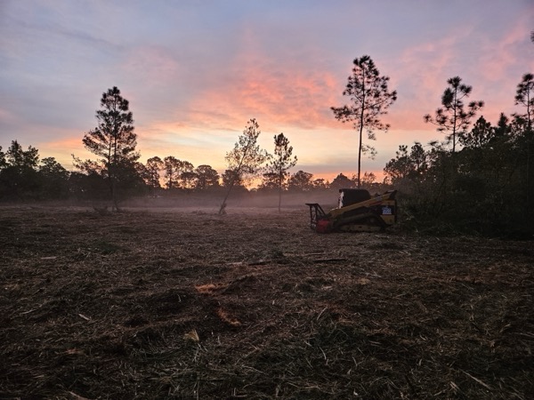
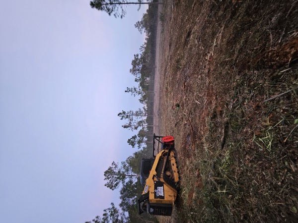
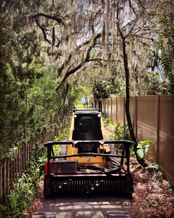
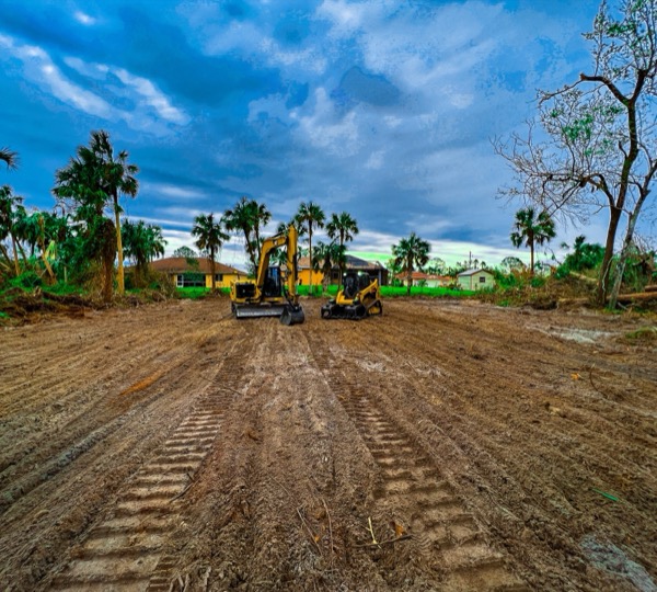
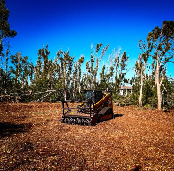
Our Work
Project Gallery
Real equipment. Real projects. Real results across Central Florida.
The TreeShop Difference
Why Property Owners Choose Us
Owner-Operated
You call. Jeremiah answers. No call centers, no runaround. Owner on every project from estimate to final walkthrough.
Outcome-Based Approach
We don't just clear land — we manage it. Every project is planned around your long-term goals, not just what needs cutting today.
10+ Years in the Field
A decade of full-time land management across Central Florida. The experience shows in how we read terrain, sequence work, and deliver results — not just in the credentials on paper.
A Real Process
Refined Master Service Agreement framework built over 10+ years. Clear scope, clear timeline, clear expectations from day one.
500+
Projects Completed
32
Counties Served
4.8
Google Rating
10+
Years Experience
Coverage
32 Counties Across Central Florida
Every county within 2.5 hours of Volusia County. Based in New Smyrna Beach. Click any county for details.
Get Started
Schedule a Land Assessment Consultation
Fill out the form and we'll get back to you within 24 hours. No pressure, no surprises. Just straight answers.
(386) 843-5266
Call or text anytime
office@treeshop.app
Email us directly
New Smyrna Beach, FL 32168
Serving 32 counties across Central FL
Request a Free Estimate
Tell us about your project and we'll respond within 24 hours.